

Solar Mapping
Instructions for using the IRENA Atlas for Solar Mapping
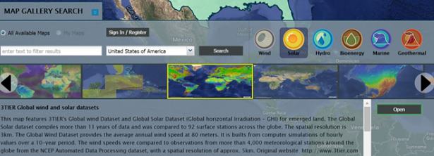
The IRENA (International Renewable Energy Agency) Global Atlas for Renewable Energy is a database of over 1000 renewable energy datasets that can be overlaid on a world map. These data allow users to visualize the renewable energy potential of wind, solar, geothermal, bioenergy, marine energy, and hydro energy, by geographic location and, in some cases, seasonality. The interface also allows users to overlay additional information such as population density, land use, or topography. Dr. Henry Potter of the DC based Naval Research Lab where his research primarily focuses on the interaction between the ocean and atmosphere, is also a SHE volunteer and prepared these simple instructions provide guidance on mapping solar energy. IRENA atlas for solar mapping_SHE